
GPX is a plain file format for tracks, routes and waypoints. GPS units, trail map apps, fitness apps and nearly every mapping tool read and write it.
Life Lever Moto records rides as GPX, imports GPX from the tools you already use, and exports GPX that any of them can open. Your track is never locked inside our app.
What the app records
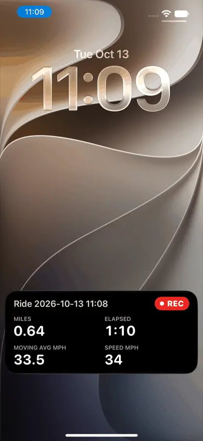
While you record (Record, Pause, Resume, End, Save, or started and ended by the bike when the data connector is on) the app asks the phone’s GPS for its best accuracy with no distance filter, which works out to one point a second. Each point stores:
- latitude and longitude
- altitude
- the time, in UTC
- speed and course, as given by the GPS
- the horizontal accuracy of that fix, in meters
Pause really pauses the GPS. Anywhere the line is not continuous (a pause, a gap) becomes a separate segment inside the same track, which is the standard way to say “do not draw a line across here”. One ride is one track.
Climb on the dashboard is a 5-point moving average that counts changes over about 10 feet.
If the app is killed you lose seconds, not rides. Distance does not count a step that ends at a fix worse than about 160 feet, or one that would mean more than about 230 feet a second.
The export
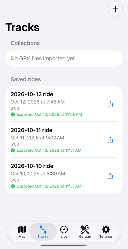
The file is standard GPX, in metric units (the app converts to miles, feet and mph on screen). It is named from the start time and the ride name, and a ride is called “Ride yyyy-MM-dd HH:mm” until you rename it.
You can share a GPX alone from the share sheet, or export to a folder through the Files picker, which works with a Google Drive or iCloud folder even offline and uploads later. Files are never overwritten; a taken name gets a counter.
What is in it
Each point has the standard fields: position, altitude, UTC time, and the widely used speed and course extensions. We add the GPS accuracy and, each second, your peak lean angle, peak cornering g and peak braking g. The ride also carries which bike and which ride view you picked.
The extras sit in GPX’s own extension slots, so a tool that does not know them skips them.
A VIN, a bike id and a track are personal. A GPX with them in it tells whoever has it where you rode and on what. Look before you share.
Engine data stays out of the GPX
Rpm, throttle and coolant are not in the GPX. There is no standard for them, and we would rather keep the GPX clean than invent one that breaks other tools. Your engine data stays with the ride in the app and in your lifelever. A pause or a lost link is a gap in the engine data, never the end of the ride.
Importing GPX
You can bring in GPX from other trail map apps and from GPS units. The app keeps these so it can write them back out unchanged:
- Names, byte for byte.
- Track colors and waypoint symbols.
- Routes.
- Extensions it does not understand.
It skips points that are not real numbers or are out of range. The original file is kept exactly as it came, so sharing the original always works.
An event hand-out is often a GPX with many tracks and waypoints in it. The 2026 Big Bear Run hard-route hand-out, our sample, has eleven tracks and nineteen waypoints. It imports as it is, and you can follow the event route as a chain of its tracks with a progress marker. See the ride page.
Maps
Maps work in two modes, and you choose between them by tapping a button, never automatically.
Trail mode is for the dirt. The trail maps are stored on the phone in regions you import, with hillshade and contour lines, and motor tracks drawn solid and footpaths thin. A region covers a box on the map. You import it through the Files picker, “Open in Moto” or a link, and you can download elevation data for it as well. One region we cut covering about 16 by 17 miles was 3.8 MB. It works with no signal. Outside a region it falls back to an online map if there is data, and otherwise says “No map data here”.
Street mode gives street directions with traffic, search and spoken guidance. It needs a connection. The directions have no motorcycle routing, so the routes are a car’s, and there is no off-road routing in either mode.
There is no satellite imagery. The map shows what its data says, tagged for motor vehicles or not. Check your local rules before you ride a trail. Map credits are always one tap away.
Trail mode can also show the trails you have actually ridden, snapped to the map, and compare two passes over the same stretch.
Where rides go
Moto works through your lifelever account, so each saved ride, your bikes and any GPX you brought go up to your record in the background whenever there is signal. lifelever turns each track in a GPX into one ride.
Once the rides are in your file, your own AI assistant can answer questions about them in your words: how your rides compare, which ride had your hardest braking, how many hours the engine really ran this month. You ask, it reads your file, and every answer points back at its rows. See Connect your assistant, and for the app itself the Moto app.